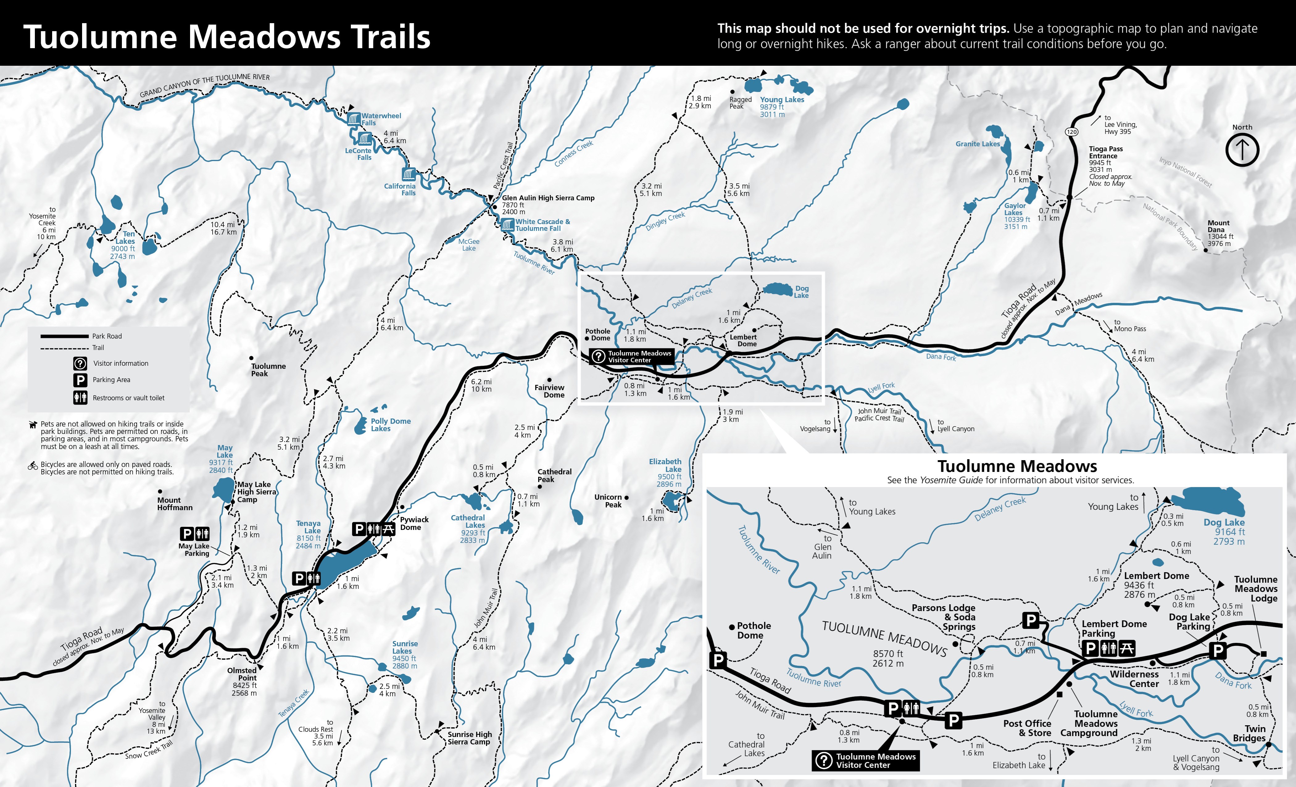
Printed atomic route distance miles
- Distance miles
- 0.7
- Distance status
- printed on official map
- End coordinate
- Latitude
- 37.85137732201024
- Longitude
- -119.4149621845829
- Geometry snapshot
- Feature id
- nps-trail-22320
- Path
- geometry/v0/snapshots/nps-yose-tuolumne-route-features-20260925.geojson
- Sha256
- d53d6a93e218c53b4e74f2e134bdcc7d97f4f8cc132c56979d650a6851a14069
- Route role
- official mainline
- Source feature id
- 22320
- Source feature name
- Unknown
- Source geometry id
- {EB866B67-4E0F-4232-84A2-7F67DEFF458C}
- Start coordinate
- Latitude
- 37.84620736597855
- Longitude
- -119.42253246623399
Evidence and sources (2)
Evidence stance: supports · Evidence details
Evidence notes: Official map confirms route membership and junction sequence.
The official 2024 Tuolumne Meadows Trails map shows the day-hike trail network, junctions, destinations, parking, restrooms, and printed leg mileages. It warns that the map is not for overnight trips and advises asking a ranger about current conditions.
Observation details · Source details · Original source: National Park Service
Evidence stance: supports · Evidence details
Evidence notes: NPS Public Trails feature 22320 supplies reviewed display geometry.
Reviewed NPS Public Trails features provide the displayed line geometry and source feature identifiers for nine Tuolumne day-hike graphs selected against the official map.
Observation details · Source details · Original source: National Park Service
Recorded artifact references
geometry/v0/snapshots/nps-yose-tuolumne-route-features-20260925.geojson
References are not a confirmation of current availability.