Evidence stance: supports

Official map confirms route membership and junction sequence.

Claims and evidence

Mapped route connector

Distance status
not printed
Route role
official mainline
Evidence and sources (1)

No claim effective interval recorded.

Spatial scope IDs: scope-tuolumne-meadows

  1. Evidence stance: supports · Evidence details

    Evidence notes: Official map confirms route membership and junction sequence.

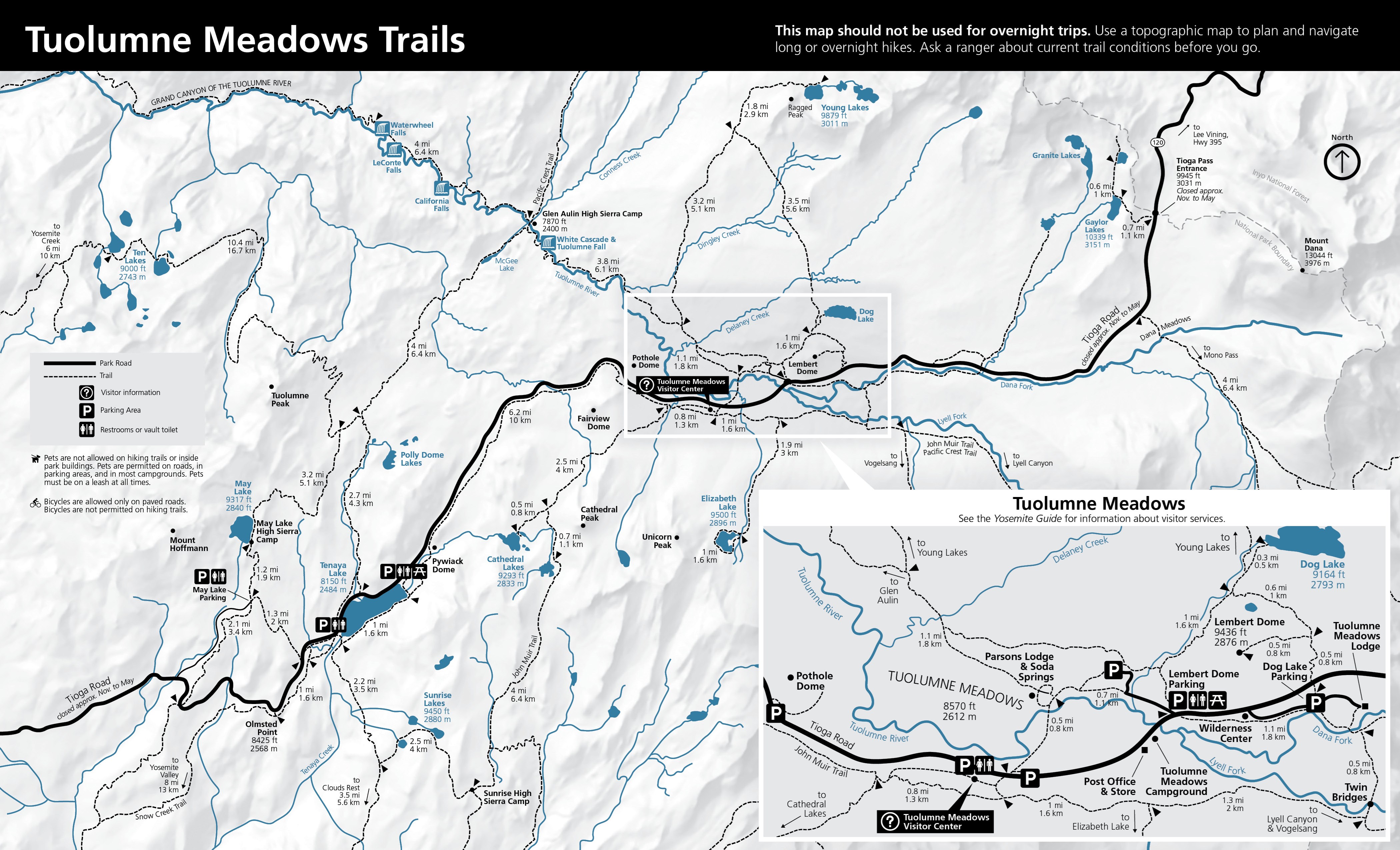
    The official 2024 Tuolumne Meadows Trails map shows the day-hike trail network, junctions, destinations, parking, restrooms, and printed leg mileages. It warns that the map is not for overnight trips and advises asking a ranger about current conditions.

    Retrieval time does not establish when an event occurred.

    Observation details · Source details · Original source: National Park Service
Recorded observations

Browse observations separately (1)

The official 2024 Tuolumne Meadows Trails map shows the day-hike trail network, junctions, destinations, parking, restrooms, and printed leg mileages. It warns that the map is not for overnight trips and advises asking a ranger about current conditions.

Retrieval time does not establish when an event occurred.

Observation details · Source details · Original source: National Park Service

Published record history

History lists published operations; it does not reconstruct removed content or confirm that external media remains available.

JSON

Historical evidence is not a guarantee of current conditions.